UNIGINE 2.14: Cumulonimbus Clouds, C# 9, Water Wave Spectrum Control, New Landscape Generator
UNIGINE SDK 2.14 is released, you can see the full release notes with technical details here.
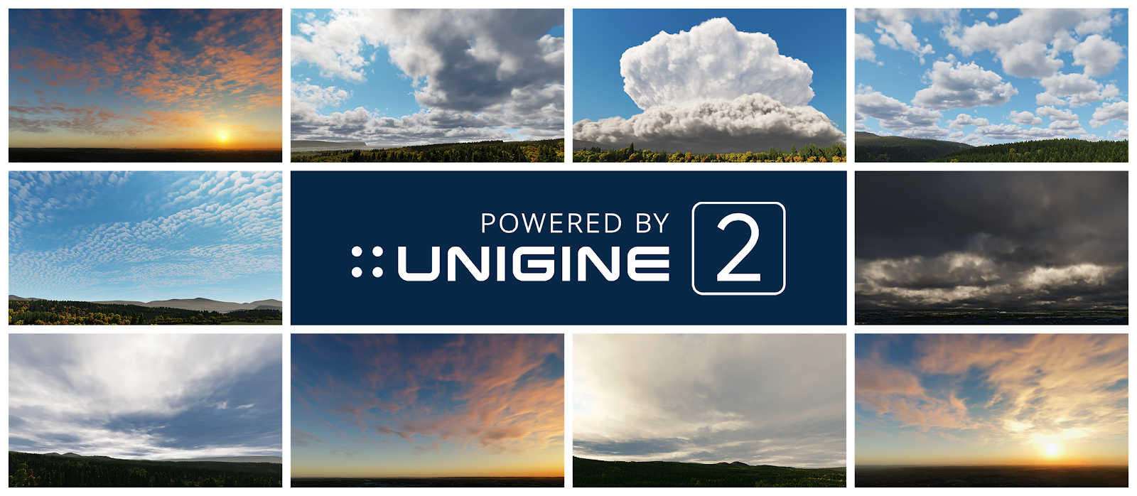
Full Set Of Cloud Types
UNIGINE’s 3D volumetric multilayer cloud system is designed specifically for enterprise flight simulators and meets the strict requirements applicable to them, offering true-to-life skies.
There are ten types of clouds in nature: Altocumulus, Altostratus, Cirrocumulus, Cirrostratus, Cirrus, Cumulonimbus, Cumulus, Nimbostratus, Stratocumulus, Stratus.
Now all of them are available right out of the box as configurable presets with a pack of performance optimizations.
Other changes in the clouds system:
- Improved cloud formation with fine control over parameters
- Improved sorting between rendering transparent objects (Alpha Blend) and volumetric clouds
- Cloud layers now can be limited to a certain area (useful for regional weather implementation)
- Improved reduction of tiling, making clouds look natural regardless of their density

New Landscape Generator: Sandworm Tool
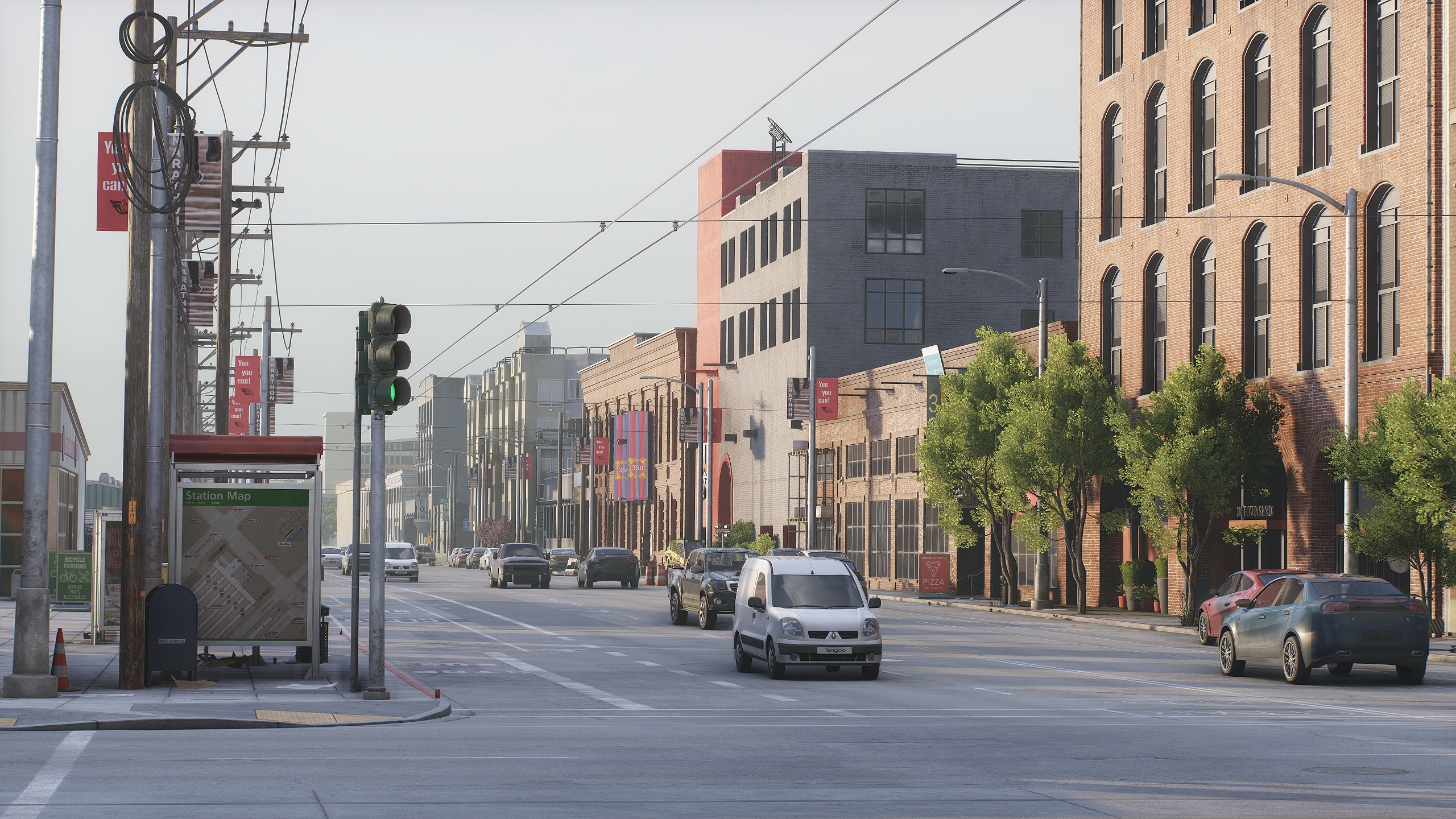
The new landscape generation tool (Sandworm) introduced in the previous release as experimental has evolved to the production-ready stage. With a lot of UI/UX improvements and a set of new features added, it enables you to generate the new Landscape Terrain based on the data from georeferenced data sources. You can use raster (elevation, imagery, and masks) and vector data sources from your local storage device, or connect to open online services (such as OpenStreetMap or various state/municipal databases) or private tile servers created and supported by users.
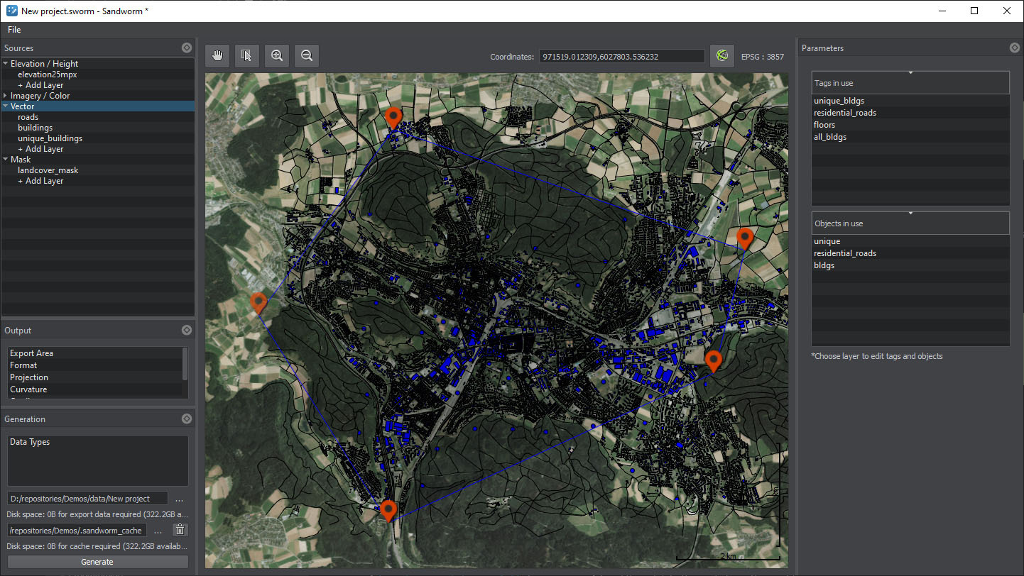
The list of Sandworm features currently includes the following:
- Support for multiple georeferenced sources raster (elevation, imagery, and masks) and vector (roads, buildings, etc.).
- Advanced data filtering options: via attributes (vector sources), via indexed, color, and channel masks (raster sources).
- Support for online TMS (Mapbox, OSM) and offline data sources.
- Mask-based generation of vegetation.
- Generation of additional details (sand, rocks, etc.) based on landcover data for more realistic landscape surfaces.
- Procedural generation of objects (roads, powerlines, buildings, landmarks, etc.).
- Advanced control and fine-tuning of placement parameters.
- Support for most of the widely used Coordinate Reference Systems (CRS) for input as well as output projections.
- Ability to combine sources with different projection types within a single project.
- Export to Landscape Terrain and Terrain Global.
Water System Upgrade (Beta)
New implementation of waves is now available offering you precise control of waves spectrum. Unique characteristics of each wave system can be set independently through spectral parameters, wave direction and speed, and the shape factor of waves (as all the data is now available on the CPU side). You can create multiple waves and wave groups (from largest to smallest) with convenient access to every parameter and an ability to control them via API at run time (e.g. processing Weather Control packets from an instructor station, etc.).

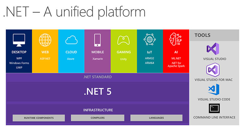
Integration of .NET 5 (C# 9)
Having started with .NET Core 2.2 and 3.1 support, we have now implemented support for .NET 5 released in November 2020 (new major .NET versions are planned annually, so we keep the pace). This update brings you many fixes and new features as well:
- Better performance.
- Garbage collection improvements (reduced memory consumption).
- C# 9.0 support with improved performance & native interop and more (for details please follow this link).
- Container size optimizations.
- Numerous bugs fixed and much more.
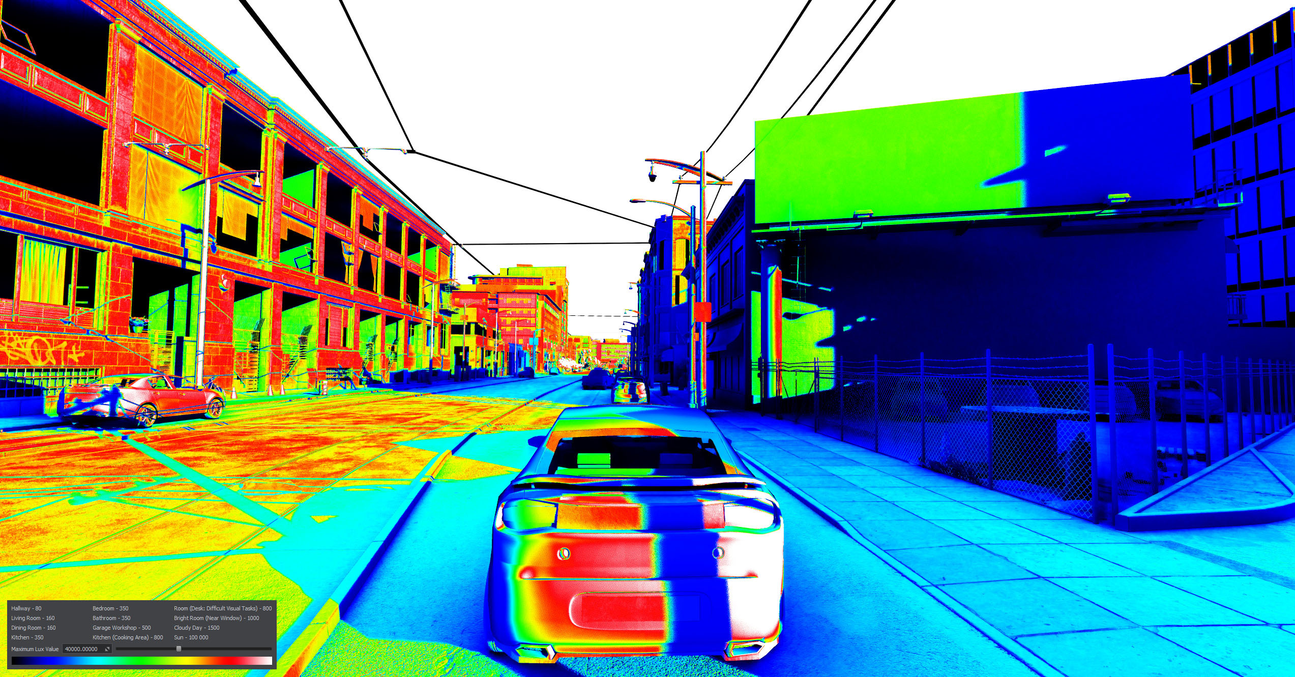
Light Meter
Introducing Light Meter - a new visual debugging tool to simplify lighting adjustment. It helps to see illuminance distribution for all surfaces in the scene as a color gradient from zero to the maximum level. So, to set up lighting for a room with a maximum light level of 350 lux set the corresponding value with the slider and simply adjust light sources, so that most of the surfaces become painted red-to-white. Recommended lighting levels are given above in the UI.
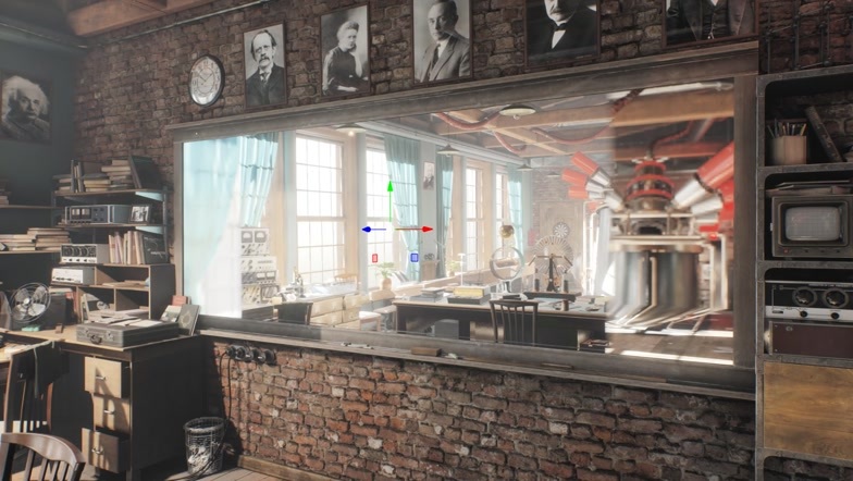
Planar Reflection Probes
Working with planar reflections has become more convenient with a new Light Planar Probe. You’re no longer bound to a certain mesh, surface, and material, as it is a separate object for grabbing and projecting reflections onto flat surfaces (mirrors, water surface, etc.) - a single probe can be used for multiple surfaces it covers. Improved rough reflections and an extended set of control parameters offer you even more flexibility.
Other Changes
The most important other changes of this release are:
- Asset packages system
- Better SSAO and bent normals
- Improved refraction sorting
- Safer execution sequence
- Improved physics update logic
- Per-effect quality presets
- Voxel probe visualizer
- Improved 2D curves support
- Improved CIGI callbacks in the Image Generator system
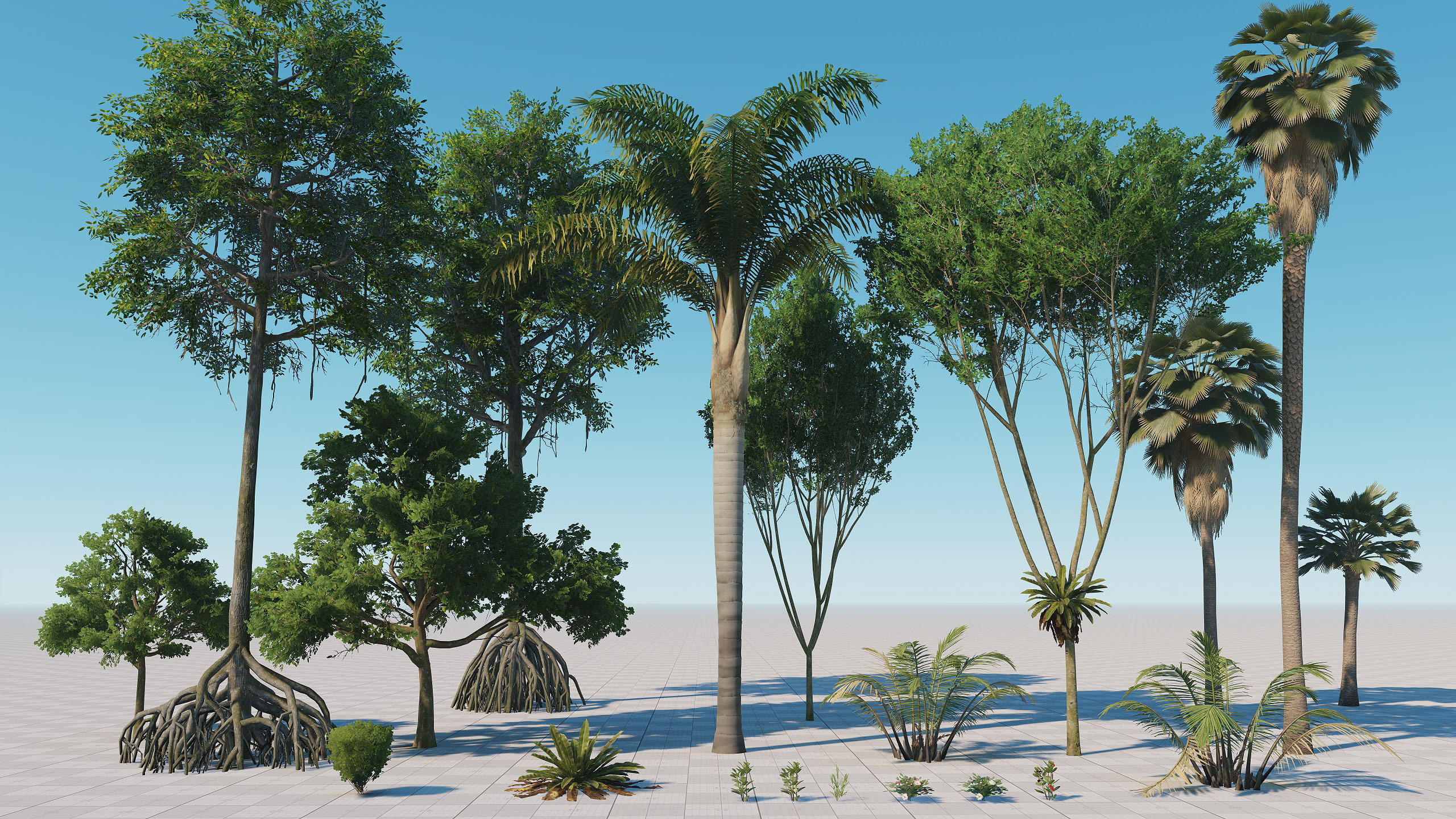
- Vegetation add-on extended with tropical plants
Check the full text of release notes on the developer portal.
Be sure to download the latest version!